U. P.
M.P.
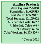
A.P.
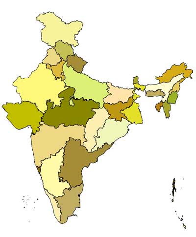
Village Information System (VIS) is a Geographical Information System (GIS) based application, which provides detailed information pertaining to demography, infrastructure
and natural resources for every village, district and state. It displays geo-referenced maps
of virtually any political boundary in India – from village to a district, a state or the entire
country with data of about 175 parameters from census of 1991 and 2001.
Users can create, query and print their own maps through interactive maps. They can
also download readymade thematic maps.
The system is currently designed for the
state of Uttarakhand. PSI is developing it for the entire country.
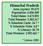
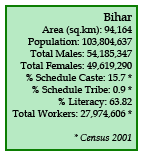
Click on Uttarakhand, Haryana, Himachal Pradesh and Bihar and follow links to pages where detailed information can be seen and maps
can be generated
and downloaded.
If you have any problem in accessing interactive GIS maps please click HELP button